Click on each image for a closer look!
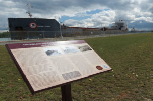
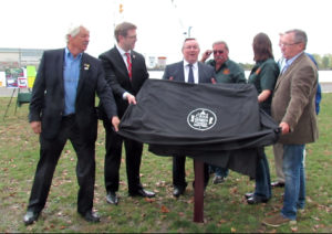
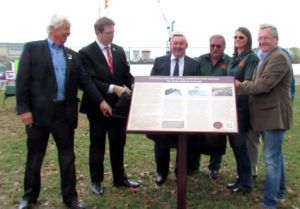
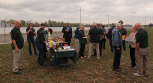
We unveiled a new historical plaque at Charles Ansell Park, on the Recreational Trail beside the Welland Canal, at the intersection of the Welland Canal Parkway and Bunting Road, St. Catharines, on Friday, October 13, 2017, at 2:00 p.m.
The plaque commemorates the Welland Ship Canal Construction Railway which was built expressly for the construction of the Fourth Welland Ship Canal, and it operated during the Canal’s construction period between 1913 and 1934. Its Main Line ran between Port Weller in the north at Lake Ontario, southwards 12 kilometres (7.5 miles) to the base of the Niagara Escarpment at Merritton. Other sections were built for the Canal’s construction in Welland and Port Colborne.
A double tracked, standard gauge main line, the WSCCR had several locomotives, rolling stock, signaling system, telephone dispatching train system, and other features just like a Class 1 railroad of its time. The Railway hauled supplies and equipment to the construction site, and tons of earth and rock away. It was not without its hazards; 37 of the 137 workers killed in the construction of the Fourth Canal, were those killed in construction accidents related to the Railway.
Tammy Frakking, President of the CRHA Niagara Division said, “If local history is not preserved, it is forgotten. The tracks are gone; little evidence remains. This plaque preserves information for the younger residents of St. Catharines, and visitors to the Niagara region. It features a unique and little-known part of the present Welland Canal’s construction history.”
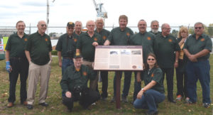
This local history plaque project was made possible by donations from the CRHA Niagara Division, and from private donations from three local residents; Art Ellis, Kenneth Gansel and Dr. Andrew Panko.
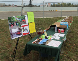
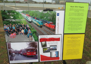
Here are some more images from the unveiling:
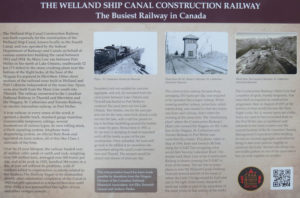
The following images and text are displayed on our CRHA Niagara NS&T plaque just south of Lock 1 of the Welland Canal in St. Catharines.
The Plaque
The Welland Ship Canal Construction Railway was built expressly for the construction of the Welland Ship Canal, known locally as the Fourth Canal and was operated by the Federal department of Railways and Canals on behalf of various contractors building the canal between 1913 and 1934. Its Main Line ran between Port Weller in the north at Lake Ontario, southwards 12 kilometres (7.5 miles) to the stone crushing plant near the bottom of the flight locks, at the base of the Niagara Escarpment in Merritton. Other short sections of the railroad were built in Welland and Port Colborne independent of the main line. Spurs were also built from the Main Line south into Thorold. The railway connected to the Canadian National Railway in Thorold and Merritton and the Niagara, St. Catharines and Toronto Railway, an electric interurban railway in Port Weller.
A true railway in every sense of the word, it sported a double track, standard gauge mainline, innumerable temporary sidings, its own rolling stock, a block signalling system, an official Rule Book and operated on train orders, all of this like Class 1 railroads of the time.
Over its 21 year lifespan, the railway hauled over 47 million cubic yards of earth and rock, withing over 100 millions tons, averaged over 200 trains per day and at its peak in 1925, handled 384 trains in a day. It was not without its problems, with 37 workers killed in construction accidents related to the railway. The railway began to be dismantled shortly after substantial completion of the Canal in 1929 but still operated in reduced function until 1934. Only a few remnants of the rights-of-way and other vestiges remain.
Tracks in the Canal Prism
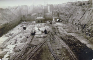
The Construction Railway’s Main Line had a number of spurs, mostly temporary, that were built as required as construction of the canal progressed. Here in August of 1925 at the bottom of what would become the Twin Flight Locks No. 4, several spurs are visible. Some are used to haul excavated shale to the Port Weller pier or sandstone and dolomite to the stone crusher near the current location of the St. Lawrence Seaway Management Corporation office building for use as concrete aggregate and others to bring in steel and concrete supplies to construct the locks. Several side dump cars are visible parked on two of the spurs and a box car with suppliers on another.
The Interlocking Plant
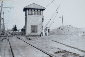
The construction railway, because busy, averaging 200 trains per day, was required to be operated like a major railway. When crossing another railway, protection, called interlocking was needed so that two trains, one from each railway, did not enter the crossing at the same time. The “interlocking plant” where the Construction railway’s Main Line crossed the Niagara-On-The-Lake line of the Niagara, St. Catharines and Toronto Railway in Port Weller was controlled b a tower. This photo, taken in May of 1916, faces east towards McNab, along the NS&T line occupying what would later become Lakeshore Road. The double track Main Line of the Construction Railway is shown crossing the NS&T in front of the tower. The rail line in many places is now the Welland Canals Parkway. Note just behind and to the left of the tower is where the Lock 1 bridge would be built. Just to the right of the tower, mounds of earth are visible as part of the excavation of the canal prism in that section of the works.
Pier Creation
Excavated rock not suitable for concrete aggregate, and soil, all excavated from the canal prism between Lake Ontario and Thorold was hauled to Port Weller to construct the canal piers out into Lake Ontario. Two trestles, one for the east pier and one for the west pier, were built almost a mile out into the lake with a rail line placed on top to facilitate back filling around the trestles to create the piers. Shown here in 1915, a 10 car train is dumping its load of excavated earth off the trestle as part of the pier construction. Once unloaded, the train will go back to be refilled at an excavation site somewhere along the canal’s route between here and Thorold. The scenario would be played out dozens of times per day.
